
Weekly Highlights
 Dominica+(tied with
  Grenada)39°C102°F Jul 26HottestSTT
 Saint Thomas33°C91°F Jul 21Coolest Dominica+(tied with
  Martinique)24°C76°F Jul 21Windiest
 Barbados34 km/h21 mph Jul 20Wettest Dominica18.2 mm0.72 in (heaviest day Jul 26: 6.8 mm0.27 in)DriestSAB
 Saba2.8 mm0.11 in
Based on data collected across 18 Eastern Caribbean islands over the past 7 days.
This Week in the Eastern Caribbean
The past seven days brought typical early hurricane season warmth and moisture to the Eastern Caribbean. Temperatures ranged from 24°C76°F overnight to 33°C91°F during the day, with Saint Thomas recording the week's high. Dominica's heat index peaked at 39°C103°F, reflecting the combination of warmth and humidity typical for late July.
Winds stayed light to moderate, with Barbados seeing the strongest gusts at 34 km/h21 mph. Rainfall was scattered across the region, with Dominica receiving the most at 18.2 mm0.72 in. Overall, Saharan dust remains low across the islands, and average atmospheric pressure held steady near 1015 mb with humidity around 86 percent.
This Week's Outlook
The coming week will maintain settled conditions with a tropical wave continuing to influence the region. The Antigua Met Office forecasts partly cloudy to cloudy skies across the Leeward and Windward Islands, with periods of showers and moderate to locally heavy rain at times. Isolated thunderstorms remain possible.
Elsewhere, fair to partly cloudy skies will dominate with only brief, isolated showers expected. Winds will push from the east-northeast at 11 to 30 km/h7 to 18 mph, becoming lighter overnight. Sea conditions will remain calm, with waves running 1 to 1.5 metres3 to 5 feet.
Tropical Activity
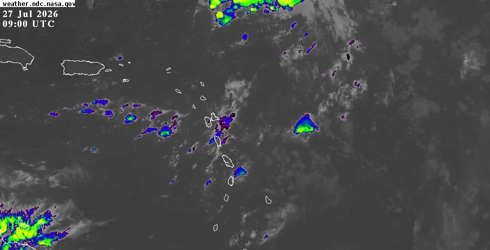
The tropics remain quiet for the Eastern Caribbean. No active tropical systems threaten the region this week. The National Hurricane Center is tracking four tropical waves across the Atlantic basin.
One wave sits far to the east near the Cape Verde Islands with no significant convection. A second wave in the central Atlantic between 44°W44°W and 48°W48°W shows scattered moderate convection, but it remains well removed from the Eastern Caribbean islands. Two additional waves lie over the western and southwestern Caribbean, well away from our region.
All waves are moving westward at typical speeds, and none currently poses a development threat. Sea surface temperatures and wind shear across the basin remain within normal ranges for early hurricane season. For the latest satellite imagery, detailed forecasts, and updated tropical weather analysis, visit the outlook page.
For island-specific conditions throughout the week, check the weather page. Live radar and satellite data for each island are available on the interactive map.