
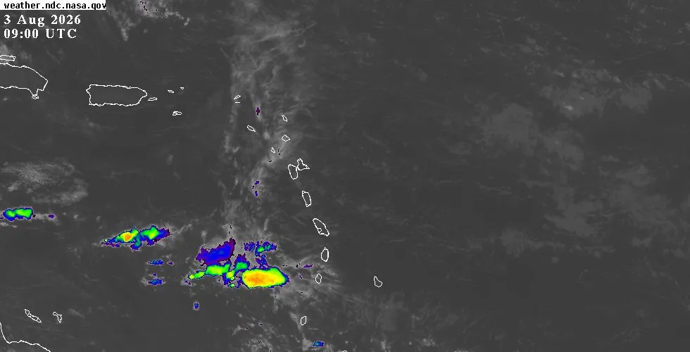
Weekly Highlights
 Dominica42°C107°F Jul 27HottestSTT
 Saint Thomas+(tied with
  British Virgin Islands)33°C91°F Jul 28Coolest
 Antigua and Barbuda24°C76°F Jul 31Windiest
 Barbados46 km/h28 mph Jul 30Wettest Dominica20.9 mm0.82 in (heaviest day Jul 29: 4.2 mm0.17 in)DriestSTA
 Sint Eustatius+(tied with British Virgin Islands)1.9 mm0.07 in
Based on data collected across 18 Eastern Caribbean islands over the past 7 days.
Regional Overview
The Eastern Caribbean is experiencing settled, stable weather as the region moves deeper into peak hurricane season. Temperatures across the 18-island network ranged from 24°C76°F at the coolest to 33°C92°F at the warmest, with Saint Thomas recording the highest readings. Humidity averaged 83%, typical for August across the Caribbean.
Cloud cover remained scattered to broken throughout the week, with only brief passing showers affecting a few locations. Winds stayed light to moderate, peaking at 46 km/h28 mph over Barbados. Saharan dust concentrations are elevated, with measurements reaching 61 µg/m³ over Saint Lucia, contributing to hazy conditions at times across the islands.
This Week's Outlook
The stable airmass anchoring the region shows no signs of retreat. Fair to partly cloudy skies will dominate through the coming days, with only a moderate chance of brief passing showers. Winds will blow from the east at 11 to 26 km/h7 to 16 mph, lightening overnight.
Sea conditions remain calm to moderate, with typical swells of 1 to 1.5 metres3 to 5 feet. Elevated dust levels are forecast to persist through the period, though no severe air quality impacts are expected at island level. Daytime temperatures will hover near seasonal norms for early August across all islands.
Tropical Activity
The tropics remain quiet for the Eastern Caribbean. No active tropical systems are affecting or approaching the islands. The National Hurricane Center is tracking tropical waves across the broader Atlantic basin, including one in the distant eastern Atlantic south of 20°N and two others over the western and central Caribbean, but none pose an immediate threat to the Lesser Antilles.
Conditions across the basin reflect peak season dynamics: abundant tropical moisture, warm sea surface temperatures, and variable wind shear across different regions. The dominant feature remains a strong high pressure system centered near 33°N 56°W, which is directing winds and moisture patterns away from the Eastern Caribbean at present. Readers seeking the full National Hurricane Center tropical weather outlook, satellite loops, and extended forecasts can visit the outlook page.
Looking Ahead
This settled pattern appears likely to hold through at least the middle of the week. The absence of active tropical threats should not breed complacency during peak season; conditions can shift rapidly. Residents and visitors are encouraged to stay informed by checking the weather page for detailed island-by-island conditions and the interactive map for live radar and satellite imagery.
The outlook page provides extended forecasts and the latest National Hurricane Center products.