
Weekly Highlights
 Dominica+(tied with
  Antigua and Barbuda)42°C107°F Sep 6Hottest
 Grenada34°C93°F Sep 6CoolestSTX
 Saint Croix22°C72°F Sep 1Windiest
 Barbados37 km/h22 mph Sep 7WettestSBH
 Saint Barthélemy38.8 mm1.53 in (heaviest day Sep 6: 12.7 mm0.5 in)DriestSAB
 Saba3.9 mm0.15 in
Based on data collected across 18 Eastern Caribbean islands over the past 7 days.
Regional Overview
The Eastern Caribbean remained in the grip of peak hurricane season this past week, with tropical wave activity and elevated dust levels shaping conditions across the island chain. Temperatures ranged from 22°C70°F at the coolest to 34°C93°F at the warmest, with Grenada recording the highest reading. Humidity remained elevated at 89% on average, while 52 µg/m³ of Saharan dust peaked over Martinique, creating hazy skies across much of the region.
Prevailing cloud cover ranged from overcast to scattered throughout the week, with Saint Barthélemy recording the wettest conditions at 38.8 mm1.53 in of rainfall. Peak winds reached 37 km/h22 mph over Barbados, while average sea-level pressure held steady at 1014 mb.
Tropical Activity
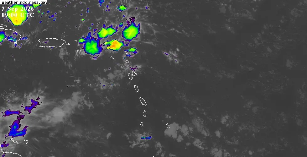
Two tropical waves moved through the Eastern Caribbean during the week, bringing periods of showers and unsettled weather to the islands. The first crossed near Saint Thomas on August 31 at its closest approach, tracking at 78 km48 mi from the island. A second wave passed at greater distance, approaching within 593 km368 mi of Saint Thomas that same day.
Both systems moved westward and have since exited the Eastern Caribbean, with their convection now affecting waters well to the west of the island chain.
The National Hurricane Center continues to track four tropical waves across the Atlantic basin, though none pose an immediate threat to the Eastern Caribbean. A far eastern Atlantic wave near 29°W is moving westward with minimal convection. A central Atlantic wave positioned near 45°W carries scattered moderate convection between 13°N and 17°N, but remains too distant to affect island weather.
A third wave along 73°W in the central Caribbean is moving slowly westward with scattered moderate convection in its vicinity, while a western Caribbean wave near 85°W is producing activity south and west of 80°W, well away from the Lesser Antilles.
No active tropical storms or hurricanes are currently affecting the Atlantic basin. The region remains in the typical pattern of September, with waves serving as the primary mechanism for tropical moisture and convective activity. For the latest outlook page, satellite imagery, and detailed NHC forecasts, check the resources provided.
This Week's Outlook
The coming week will feature light southeasterly winds at 11 to 26 km/h7 to 16 mph, with daytime heating and available low-level moisture triggering periods of localized showers and thunderstorms. Some showers could become moderate to locally heavy at times. Sea conditions are expected to remain modest at 1 to 1.5 metres3 to 5 feet.
The combination of typical September heat, humidity, and the persistent tropical wave threat means residents should remain vigilant for brief heavy downpours and gusty wind squalls associated with isolated thunderstorms, particularly during afternoon and evening hours.
For island-specific forecasts and detailed conditions, visit the weather page. To explore live satellite and radar imagery for each island, access the interactive map. The full outlook page provides extended forecasts, model guidance, and the latest NHC discussion.