
Weekly Highlights
 Martinique+(tied with
  Grenada)42°C107°F Aug 18HottestSTT
 Saint Thomas34°C93°F Aug 20Coolest
 St Vincent+(tied with
  Antigua and Barbuda)25°C77°F Aug 17Windiest
 Barbados50 km/h31 mph Aug 21Wettest
 Dominica61.8 mm2.43 in (heaviest day Aug 18: 18 mm0.71 in)Driest
 British Virgin Islands3.1 mm0.12 in
Based on data collected across 18 Eastern Caribbean islands over the past 7 days.
Weekly Regional Summary
The Eastern Caribbean experienced typical peak season conditions over the past week, marked by the passage of a tropical wave midweek and lingering moisture that influenced rainfall across the island chain. Temperatures ranged from 25°C77°F to 34°C93°F, with Saint Thomas recording the highest readings at 34°C93°F. Feels-like temperatures climbed to 42°C109°F in Martinique as humidity hovered near 85%.
Peak winds reached 50 km/h31 mph at Barbados, while Dominica received the most rainfall at 61.8 mm2.43 in. Saharan dust concentrations remained elevated across the region, peaking at 29 µg/m³ over Barbados, contributing to hazy conditions typical of late summer. Atmospheric pressure averaged 1015 mb, and sky conditions favoured a mix of scattered to few clouds throughout the period.
This Week's Outlook
The coming week will maintain peak season characteristics as a high pressure ridge gradually establishes itself over the region. Today begins with lingering moisture and instability from the tropical wave that crossed earlier, keeping a heightened chance of brief passing showers over the island chain through this morning and into early afternoon before conditions improve tonight. Winds will remain light to moderate, blowing from the east at 11 to 30 km/h7 to 18 mph with lighter spells at times.
Sea conditions remain manageable, averaging 1 to 1.5 metres3 to 5 feet. As the week progresses, tropical waves are expected to move across the broader Atlantic and Caribbean basin, but most development is forecast far from the Eastern Caribbean islands. Environmental conditions remain marginally conducive for development in the central and eastern Atlantic, with a potential tropical depression possible by midweek to late week over those distant waters.
The outlook page provides the full National Hurricane Center tropical weather outlook, satellite imagery, and forecast graphics for detailed tracking.
Tropical Activity
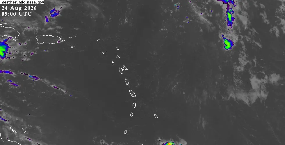
A tropical wave crossed the Eastern Caribbean on August 23 to 24, tracking closest to Anguilla at 1118 km695 mi away on August 23 before moving westward into the central Caribbean and dissipating. This system brought scattered showers and brief wind pulses across the islands early in the week, with Dominica recording the heaviest rainfall associated with the wave's passage. A second disturbance tracked near the region August 21 to 23, approaching within 1166 km725 mi of Anguilla on August 22 before also moving away.
The National Hurricane Center is monitoring a subtropical system (AL95) developing about 640 km400 mi southeast of Bermuda in the central subtropical Atlantic, well northeast of the Eastern Caribbean. This system carries a medium chance of becoming a short-lived tropical depression or storm over the next 48 hours to 7 days, but poses no threat to the Caribbean islands. Multiple tropical waves continue to move westward across the Atlantic basin, with scattered moderate convection noted over distant regions from Africa through the eastern Atlantic.
None of these systems are expected to significantly affect the Eastern Caribbean during the week ahead. For current satellite imagery and tracking of all Atlantic systems, visit the outlook page.
Looking Ahead
Conditions favour a typical peak season week with modest tropical activity well removed from the islands. Readers seeking detailed island-by-island weather forecasts, current conditions, and air quality information should visit the weather page. The interactive map offers live radar and satellite views by location, and the archive contains historical storm data and seasonal climatology for reference.