
Weekly Highlights
 Saint Martin42°C107°F Aug 14HottestSTT
 Saint Thomas35°C95°F Aug 15Coolest
 Antigua and Barbuda24°C76°F Aug 11Windiest
 Barbados+(tied with
  Saint Lucia)51 km/h31 mph Aug 14Wettest
 Dominica112.8 mm4.44 in (heaviest day Aug 15: 52.9 mm2.08 in)Driest
 Anguilla7.5 mm0.3 in
Based on data collected across 18 Eastern Caribbean islands over the past 7 days.
This Week's Regional Overview
The Eastern Caribbean remained settled over the past seven days with no active tropical systems affecting the islands. Temperatures ranged from a low of 24°C76°F in Antigua and Barbuda to a high of 35°C96°F across Saint Thomas, with conditions feeling considerably warmer in some locations. Saint Martin recorded a feels-like temperature of 42°C107°F due to the combination of heat and humidity.
Scattered clouds and brief showers dominated across the region, with Dominica recording the wettest conditions at 112.8 mm4.44 in and Anguilla the driest at 7.5 mm0.3 in. Average humidity held steady at 83% across the islands, typical for this time of year. Elevated Saharan dust was present throughout the region, with peak concentrations of 36 µg/m³ recorded over Dominica, contributing to hazy skies in some areas.
This Week's Outlook
The coming week will maintain the settled pattern established over the past few days. Stable conditions are expected as a tropical wave moves away from the area. East winds of 19 to 31 km/h12 to 20 mph will prevail, with scattered cloudiness and brief showers possible as pockets of moisture interact with the moderate wind flow.
Sea heights will remain moderate at 1.5 to 2.4 meters5 to 8 feet. Typical peak-season weather patterns are expected to hold, with no significant weather disruptions anticipated for the region through the forecast period.
Tropical Activity
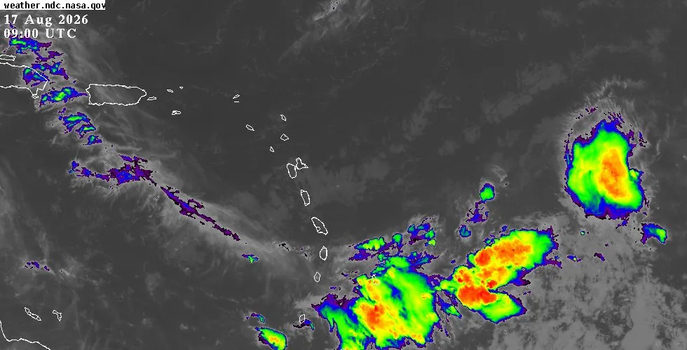
The tropics remain quiet for the Eastern Caribbean. No active tropical systems pose a threat to the islands, and atmospheric conditions continue to support the stable pattern currently in place. The National Hurricane Center is monitoring several tropical waves across the Atlantic basin, but none are approaching or affecting our region.
A tropical wave has moved through and away from the area; waves over the central and western Caribbean are located well west of our islands and remain focused on impacts to other parts of the basin. The Atlantic remains under typical August influences, with moderate to fresh trade winds supporting near-normal sea conditions across most waters. Visit the outlook page for the full NHC tropical weather discussion, satellite imagery, and extended forecasts.
Looking Ahead
Peak hurricane season continues through September, and while activity remains quiet now, residents are reminded to stay informed about developing systems. For detailed conditions specific to each island, visit the weather page. Check the outlook page for the latest forecast graphics and tropical analysis, and use the interactive map to view live radar and satellite imagery by location.