
Weekly Highlights
 Saint Thomas34°C93°F Jul 11Coolest
 St Vincent(tied with
  Barbados)25°C77°F Jul 12Windiest Barbados45 km/h28 mph Jul 10Wettest
 Dominica40.5 mm1.59 in (Jul 6, 16.1 mm0.63 in)Driest
 Sint Eustatius0.1 mm0 in
Based on data collected across 18 Eastern Caribbean islands over the past 7 days.
Regional Conditions This Week
The Eastern Caribbean is experiencing typical early-season activity with warm temperatures and moderate trade winds. Across the region over the past seven days, temperatures ranged from 25°C77°F to 34°C93°F, with the warmest readings in the northern islands and cooler air over the southern Windwards. Scattered to broken cloud cover dominated skies, with moisture-driven shower activity concentrated in the south.
Saint Thomas recorded the highest temperature at 34°C93°F, while peak winds reached 45 km/h28 mph across Barbados. Dominica experienced the heaviest rainfall at 40.5 mm1.59 in, reflecting the active convection typical of the season. Average atmospheric pressure held steady at 1016 mb, and regional humidity averaged 84 percent.
This Week's Outlook
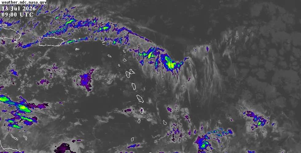
A tropical wave currently positioned south of 19°N19°N along 77°W77°W is moving westward at 24 to 37 km/h15 to 20 mph. This system will bring showers and thunderstorms to the Southern Windwards, including Dominica, Saint Lucia, Saint Vincent, and the Grenadines, as well as Trinidad and Tobago through Monday night. The Leeward Islands northward to Puerto Rico will experience suppressed shower activity due to Saharan dust and lower moisture levels, though the northern edge of the tropical wave will still be felt.
Easterly winds will generally range from 19 to 33 km/h12 to 21 mph with occasional gusts. Seas across the region will remain relatively modest at 1 to 2.1 metres3 to 7 feet. As the week progresses, lighter winds and fair conditions should develop across most areas by mid-week, though an extensive subtropical ridge will continue to support moderate to fresh trades south of 23°N23°N.
Tropical Activity
The National Hurricane Center continues to monitor the tropical wave affecting the central Caribbean this week. Significant convection remains focused over northwestern Colombia and Panama along the southern portion of the system, with scattered to isolated strong thunderstorms marking the wave's progression. The broader Atlantic basin is dominated by a strong subtropical ridge that supports fresh to locally strong easterly trade winds across much of the tropical Atlantic.
Moderate seas are developing south of 22°N22°N west of 40°W40°W, while pulsing strong winds are expected near Hispaniola and through the Windward Passage during evening hours. There are no active tropical systems posing an immediate threat to the Eastern Caribbean at this time. The combination of Saharan dust intrusion, stable atmospheric conditions across the northern Atlantic, and prevailing wind shear continues to limit organization.
For the latest NHC tropical weather outlook, detailed satellite imagery, and extended forecast graphics, visit the outlook page.
Residents and visitors throughout the Eastern Caribbean should monitor conditions closely over the coming days, particularly those in the Southern Windwards where shower and thunderstorm activity will be most pronounced. For detailed island-by-island conditions, including hourly updates and extended forecasts, visit the weather page. Check the interactive weather map for live radar and satellite imagery across the region.