
Weekly Highlights
 Saint Thomas34°C93°F Jul 5Coolest
 Saba23°C73°F Jul 6Windiest
 Saint Kitts and Nevis35 km/h22 mph Jul 2Wettest
 Dominica49.2 mm1.94 in (Jul 6, 10.5 mm0.41 in)Driest Sint Eustatius0 mm0 in
Based on data collected across 18 Eastern Caribbean islands over the past 7 days.
Regional Conditions This Past Week
The Eastern Caribbean experienced generally warm and humid conditions over the past seven days, with temperatures ranging from 23°C74°F in the higher elevations to 34°C94°F across lower-lying areas. Saint Thomas recorded the highest readings at 34°C94°F, while Saba's cooler elevation yielded lows of 23°C74°F. Humidity remained elevated at 84% on average, typical for early hurricane season.
Rainfall was spotty across the region, with Dominica receiving 49.2 mm1.94 in while Sint Eustatius remained completely dry. Trade winds strengthened toward the end of the period, with Saint Kitts and Nevis recording gusts of 35 km/h22 mph. Saharan dust haze persisted throughout, degrading air quality across the entire region.
This Week's Outlook
Conditions will split this week between the Leeward Islands and the Windward Islands. The Leeward Islands and areas from Puerto Rico westward will remain mostly dry and hazy, with stable skies continuing through Tuesday. By contrast, moisture flowing across the Windward Islands and southward to Trinidad and Tobago will generate scattered showers and possible thunderstorms, particularly over the next 24 hours.
Winds will remain predominantly east-southeasterly, with seas building slightly to 1.2 to 2.4 metres4 to 8 feet. Saharan dust haze will continue to reduce visibility and air quality island-wide. By midweek, conditions are expected to remain relatively steady with east to southeast winds between 10 to 15 km/h10 to 15 mph across most waters.
Tropical Activity
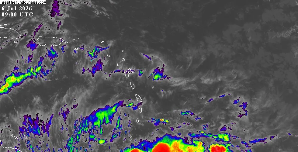
The Atlantic basin remains free of organized tropical systems as the region enters early July. The National Hurricane Center is currently tracking four separate tropical waves across the Atlantic and Caribbean basins, all moving westward at typical speeds. The most active wave is positioned near 79°W79°W south of 19°N19°N, showing scattered moderate convection between 11°N11°N and 20°N20°N.
Three additional waves are being monitored at various longitudes farther east, all advancing westward at speeds of 10 to 15 km/h10 to 15 knots. The Atlantic subtropical ridge is anchored firmly north of 20 degrees north and will continue to steer these systems westward over the coming week. Sea surface temperatures remain warm across the Caribbean, and wind shear patterns are currently unfavorable for rapid tropical development.
Saharan dust continues to inhibit convective organization throughout the basin. For detailed tracking of these waves, satellite imagery, and the extended tropical outlook, visit the outlook page.
Residents and visitors should monitor island-specific conditions on the weather page, especially those in the Windward Islands where shower activity will be most frequent. For live radar, satellite imagery, and zone-by-zone monitoring, the interactive map provides real-time updates throughout the region.