

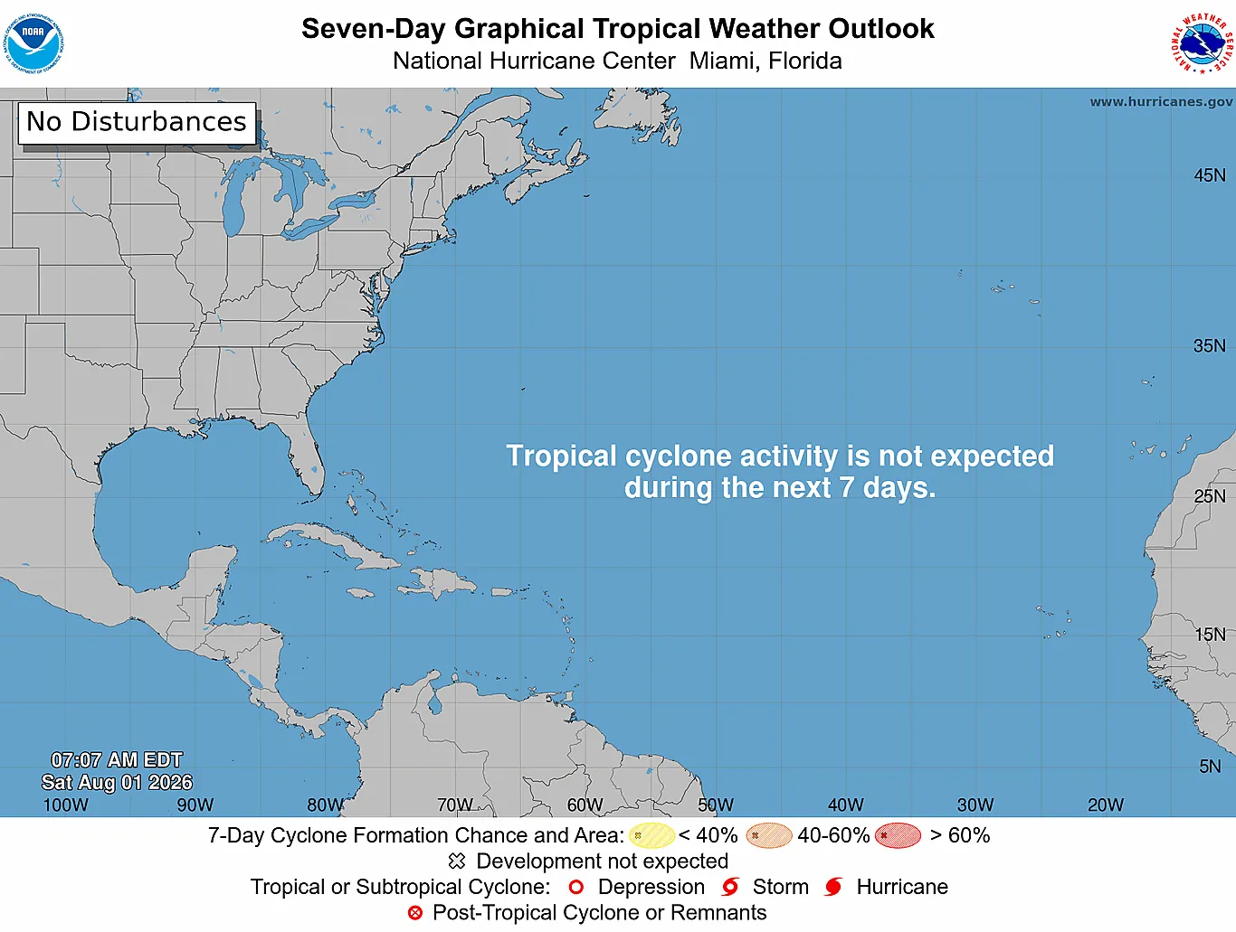
August marks the official entry into peak hurricane season, but the Atlantic basin remains unusually quiet for this time of year. Through early August 2026, only 2 named storms have occurred, and no hurricanes have formed yet. The basin is currently free of active tropical systems, and the National Hurricane Center forecasts no tropical cyclone formation over the next 7 days.
For the Eastern Caribbean, this means a relatively calm stretch ahead, though residents and travelers should remain weather-aware as the season progresses.
Season Snapshot
Atlantic season runs June 1 to November 30. Storm counts for 2026 from the Dewedda.com tracking database; season averages from NOAA 1991-2020 climatology. Track activity live on the interactive map.
Season Activity to Date
The 2026 Atlantic hurricane season opened below the long-term pace established by NOAA's 1991-2020 climatology. Through early August, 2 named storms have reached peak intensities of at least 63 km/h39 mph (34 knots). No hurricanes, and no major hurricanes, have developed.
For comparison, the 30-year average calls for approximately 14 named storms, 7 hurricanes, and 3 major hurricanes across a full season running from June 1 through November 30. This slow start aligns with seasonal forecasts issued in May and updated in July by Colorado State University (CSU) and other modeling centers that predict well below-normal activity for the basin.
Current Basin Conditions
Tropical wave activity is present across the Atlantic, but none pose immediate threat to the Eastern Caribbean. The National Hurricane Center's current Atlantic discussion identifies three tropical waves: one in the eastern Atlantic near 24°W moving westward, a second in the central Atlantic near 49°W, and a third over the eastern Caribbean near 68°W. The easternmost wave, which moved across the Eastern Caribbean early in August, brought scattered showers and gusty winds to the region but has since continued its westward track without intensification.
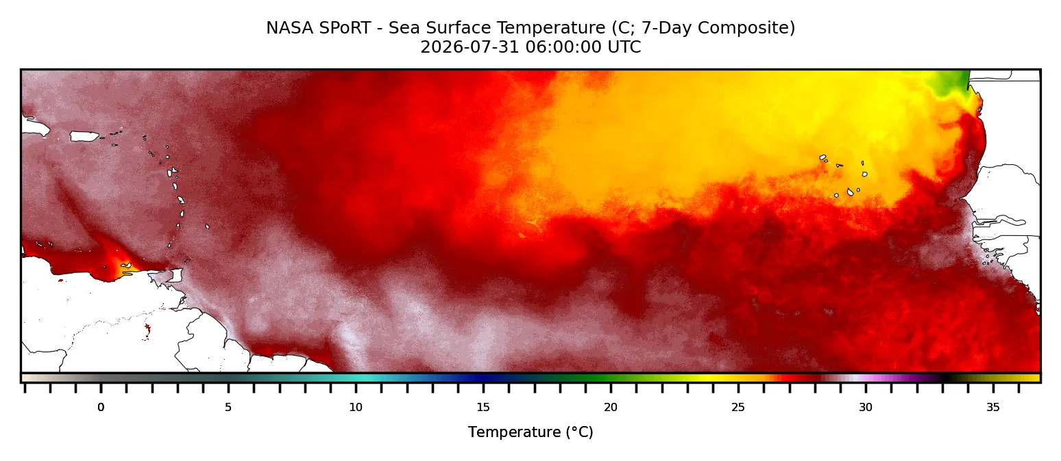
Sea surface temperatures across the tropical Atlantic remain the primary driver of seasonal suppression. Strong El Niño conditions, expected to intensify through the peak months of August through October, create an atmospheric environment hostile to hurricane development. El Niño typically strengthens upper-level wind shear across the Atlantic basin, the change in wind speed and direction with altitude, which tears apart developing storm systems before they can organize.
CSU's July forecast update noted that moderate El Niño conditions are likely to intensify, with a high potential for strong El Niño during the peak season.
Offshore waters around the Eastern Caribbean show expected patterns for early August. The Leeward Islands region is experiencing east to southeast winds of 19 to 28 km/h12 to 17 mph in Caribbean waters, with seas ranging from 1.5 to 1.8 meters5 to 6 feet. The Windward Islands region shows slightly stronger trade winds at 28 to 37 km/h17 to 23 mph in some areas, with seas of 1.2 to 1.8 meters4 to 6 feet.
These are typical conditions for the season and do not indicate tropical system development.
What Forecasters Expect for the Rest of August
According to NOAA's Climate Prediction Center, Atlantic basin Accumulated Cyclone Energy (ACE) and net tropical cyclone activity in 2026 are forecast to reach approximately 40 to 45 percent of their long-term averages. This represents a significantly suppressed season. CSU's most recent update, issued on July 8, characterizes 2026 as a "well below-normal season" and estimates ACE at roughly 55 to 60 percent of average depending on the forecast iteration.
While September 10 marks the climatological peak of the Atlantic hurricane season, when storm frequency typically reaches its maximum, the combination of El Niño effects and current atmospheric patterns suggests that even the peak months may see well-below-average activity in 2026. The next named storms in the 2026 season will be Cristobal, Dolly, and Edouard, but forecasters do not expect rapid development through August.
Eastern Caribbean Perspective
For Eastern Caribbean residents and visitors, August 2026 presents a lower-risk window compared to historical norms for this time of year. The islands from the Virgin Islands south to Grenada are not threatened by any current systems, and the basin-wide suppression suggests a reduced probability of major hurricane impacts through at least mid-month. However, the season is not over: September and October typically bring the year's most active periods, and a single tropical system can always bring significant impacts regardless of overall seasonal predictions.
Travelers planning to visit the Eastern Caribbean should continue normal preparations. Small craft operators and water sports enthusiasts should monitor trade wind forecasts and local sea state conditions, which will vary day to day. The tracking map and forecast outlook tools are available for real-time monitoring as conditions evolve.
Staying Prepared
NOAA emphasizes that even in below-normal seasons, hurricanes and tropical storms can occur at any time. A single hurricane, or even a tropical storm, can cause significant damage and disruption. Residents should maintain updated emergency kits, know evacuation routes, and stay informed through official National Hurricane Center advisories.
This month's quieter conditions provide an opportunity to review preparedness plans, ensure supply stocks are current, and verify that household and business continuity procedures are in place. Quiet August does not mean a quiet September or October.